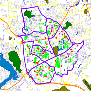
 If we were to stop people on the street and ask, “What do you think a company named ‘Mapcom’ does?” we guarantee the majority of responses would have something to do with mapping. While it seems like common sense to assume we’re simply a mapping company, it’s not quite all we do.
The “-com” in our name comes from the Latin word for “together” and signifies our focus on communication. Mapcom Systems brings the value of visual rendering and the convenience of dynamic communication together in one user-friendly, intelligent platform.
“Penn State chose to implement M4 for management of its thousands of AutoCAD drawings and spreadsheets that detailed the inside and outside plant physical infrastructure,” says Travis Lunglhofer from Penn State University. “When using AutoCAD, there was no way to search drawings for information, there was a need to open multiple drawings, there was no linking to their telecommunications management system which caused staff to have several programs open at once while researching information on active or requested services. This approach also required updating several sources of information to keep the facilities records up to date since nothing was integrated. By implementing the M4 product, Penn State will be able to maintain all of their infrastructure information in one common database accessed by both M4 and Pinnacle instead of the many separate standalone systems. We will reduce the number of steps required to update drawings and databases, and aim to have two-way integration that will allow information to be entered in either product and the updates are passed back and forth.”
Travis highlights many of the solutions M4 delivers and also notes the limitations of digital maps used to represent infrastructure. M4 is built with a database that underpins the maps and integration between operations systems, sales, technicians, and executives. In short, it’s a map with many layers of information.
Digital map records were a brilliant innovation that allowed centralized storage of records, off-site backups, and electronic sharing. But as the use of digital maps spread, their limitations became more obvious. They are usually broken into digestible chunks: parts that fit on a screen, parts that fit on a piece of paper to print, parts of mapped infrastructure, etc. Even if the maps themselves are digital, users still must piece together information from multiple sources manually.
Digital maps are made up of lines, figures, and labels. A limitation of digital maps is that they can’t contain all of the information about the three-dimensional elements they depict. Consequently, this information is recorded in separate databases or spreadsheets with no linkage except by label to the map. The lack of linking means more manual processes and more mental gymnastics. We live in the era of “search”, and typical digital maps have lagged woefully behind on the latest search technologies, limiting the spread of digital map use. The data stored in the map might as well be locked in a vault and buried in a time capsule.
Another big limitation of existing digital maps is their reflection of current data. They lack integration with provisioning systems, element management systems, network monitoring systems, and customer relationship systems. Users of the digital maps accept that the data they depict was just a one-time slice of history, and then must piece together what happened since that snapshot. Because digital maps are out of date almost as soon they are completed, installation and sales engineering can’t get an accurate picture of available inventory without reaching out to multiple departments. These manual communication processes slow everything down.
It doesn’t need to be this way. With Visual Operations Systems like M4 Solutions, your maps can work harder and smarter. Next week we’ll walk you through how it’s done.
