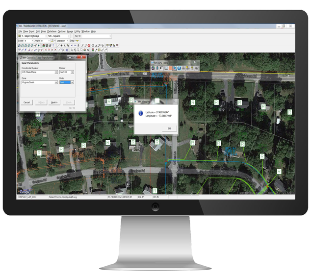
M4 GPS Tools
Simplify GPS data collection and transform it into valuable reports.
Overview
With superior functionality and performance, M4 GPS Tools sources GPS data collected from the field and automatically populates the M4 database. This powerful system facilitates OSP record creation and ensures the most accurate data for use in M4 CPR.
Features
- Find latitude and longitude of any point on the map
- Coordinate translator allows for simple data translation from one coordinate system to another
- Import AutoCAD and ESRI files into M4
- Efficient flow from collection of GPS data into M4
Benefits
- Effortlessly-source GPS data and automatically populated fields in the M4 database
- Simplify creation and maintenance of land based maps
- Quickly prepare data for the completion of FCC Form 477
%
Average time saved per day for dispatchers using M4
M4 Solutions

Generate Records from GPS Data
Easily take GPS coordinates gathered in the field and use them to track and maintain assets. The toolbar allows users to find the latitude and longitude of any point on the map, or find a point on the map using latitude and longitude.
Prepare for FCC Form Submission
M4 GPS Tools also features the ability to translate values in a database table from one coordinate system to another. Once GPS data has been brought into M4, the information can be used to simplify the completion of FCC Form 477.
Integrate with Handheld and Truck GPS Units
M4 GPS Tools work with almost any handheld GPS receiver. We partner with GPS manufacturers to ensure a high level of efficiency in taking field data and turning it into usable M4 records. Additionally, a completely configurable data dictionary allows users to choose which information is collected.
Highlighted M4 Modules
Want an in-depth look at how this M4 module works? Let's talk!


